Varble, ..., Öktem, ..., Romps, ..., Utilizing a storm-generating hotspot to study convective cloud transitions: The CACTI experiment, BAMS, 2021
Paper
Data
Description
The Cloud, Aerosol, and Complex Terrain Interactions (CACTI) field campaign was designed to study the clouds that develop with regularity over the Sierras de Cordoba mountain range in Argentina between October 2018 and April 2019. This field campaign included a Gulfstream-1 aircraft, a C-band scanning radar to measure precipitation, and a large array of other instruments, including the ARM Stereo Cameras that we developed for the Department of Energy and for which we serve as instrument mentors.
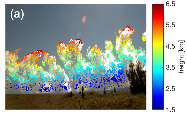
The two stereo cameras were located to the east of the main CACTI site and faced west towards the mountain range. These cameras provide a unique dataset for CACTI: they measure the evolving envelope of the clouds as they develop during the day, providing information on turret sizes, ascent speeds, and the development of anvil clouds.
The clouds developing over the Sierras de Cordoba as seen by one of the ARM Stereo Cameras. Color-coded squares indicate the height of that part of the cloud, as obtained from the Point Cloud of Clouds Points Product developed at LBNL.
